
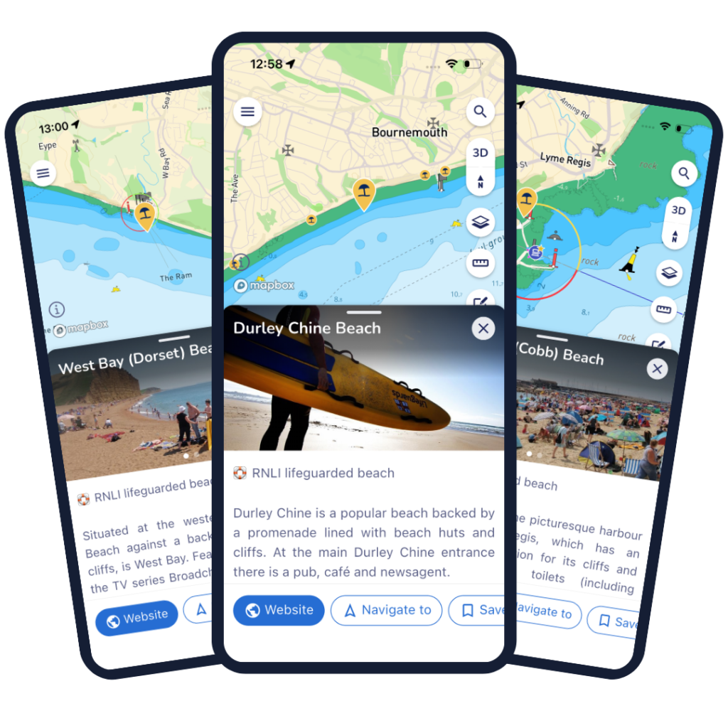
Marine navigation app Savvy Navvy has expanded its safety features by adding RNLI lifeguarded beaches across the UK and Ireland to its platform, supporting the Royal National Lifeboat Institution’s (RNLI) 25th anniversary lifeguarding campaign.
The update means users can now view all RNLI lifeguarded beaches alongside existing RNLI lifeguard station locations within the app, providing boaters, paddleboarders, kayakers and other water users with a more complete picture of coastal safety infrastructure.
The announcement comes ahead of International Lifeguard Appreciation Day on 31 July, when the RNLI will celebrate 25 years of lifeguarding with events recognising the organisation’s contribution to saving lives around the UK’s coastline.
Industry Significance
Digital navigation continues to play an increasingly important role in recreational boating and watersports, with safety becoming a key differentiator for marine technology providers.
By integrating RNLI lifeguarded beach locations directly into its platform, Savvy Navvy is extending its role beyond route planning and navigation to become a broader coastal safety tool.
The collaboration reflects a growing trend within the marine sector, where technology companies are partnering with charities and safety organisations to improve awareness and reduce incidents on the water.
The partnership between Savvy Navvy and the RNLI began in July 2025 and has since expanded to include several initiatives supporting both operational volunteers and public education.
David Cusworth, Head of Partnership and Innovation at Savvy Navvy, said:
“As the RNLI celebrates 25 years of lifeguarding with a global celebration campaign, it felt like the right moment to bring this data together and make it easy for boaters and beachgoers alike to find a lifeguarded beach, alongside the already visible lifeguard stations.
“We appreciate all the lifeguards and are proud to continue to support the RNLI in their vital mission to save lives at sea and promote water safety.”
Technical Details
The latest update incorporates every RNLI lifeguarded beach across the UK and Ireland into the Savvy Navvy platform.
Users already had access to RNLI lifeguard station locations, but the addition of beach-specific data provides more detailed situational awareness when planning coastal trips.
The enhancement complements Savvy Navvy’s existing navigation capabilities, which combine electronic charting with real-time weather, tidal information, wave forecasts, vessel specifications and local regulations to calculate intelligent routes and estimated arrival times.
Often described as the “Google Maps for boats”, the application has now been downloaded more than three million times worldwide, serving recreational sailors, motorboaters, paddleboarders, kayakers and personal watercraft users.
Commercial Impact
The continued collaboration demonstrates how partnerships between marine technology companies and charitable organisations can deliver value beyond traditional sponsorship.
More than 1,400 RNLI operational volunteers have taken up Savvy Navvy accounts since the partnership launched, while the company also donates a proportion of subscription revenue from selected RNLI shop sales back to the charity.
For Savvy Navvy, integrating trusted safety data strengthens the app’s appeal within an increasingly competitive marine navigation market.
For the RNLI, greater visibility of lifeguarded beaches through a widely used navigation platform provides another opportunity to promote safer decision-making among recreational water users.
Steve Hulbert, Senior Commercial Partnerships Manager at the RNLI, said:
“The RNLI’s people are its most valuable asset, and we’re delighted that it is recognised by our trusted partner Savvy Navvy offering their brilliant navigation app.
“It’s so heartening when companies recognise the commitment of RNLI people and reward them for the courageous work they do.”
Market Context
The RNLI’s lifeguard service has grown significantly since its launch in 2001.
Today, RNLI lifeguards patrol more than 245 beaches across the UK and Channel Islands.
Over the past 25 years they have:
- Responded to more than 333,000 incidents
- Assisted over 440,000 people
- Saved more than 2,000 lives
As recreational boating, paddle sports and coastal tourism continue to grow, access to reliable safety information has become increasingly important for both experienced mariners and first-time water users.
The integration of verified safety infrastructure into digital navigation platforms reflects wider developments in marine technology, where real-time information is becoming central to voyage planning and risk management.
What Happens Next
The new beach data is now available within the Savvy Navvy app ahead of the RNLI’s International Lifeguard Appreciation Day celebrations on 31 July.
The anniversary campaign will feature events across the UK recognising the work of RNLI lifeguards and highlighting the charity’s continued commitment to coastal safety.
As digital navigation platforms continue to evolve, further integration of official marine safety information is likely to become an increasingly valuable feature for recreational users navigating busy coastal waters.
Boatbuilding News Analysis
The addition of RNLI lifeguarded beaches highlights how marine navigation platforms are evolving beyond chart plotting into comprehensive safety ecosystems. As connected marine technology becomes more sophisticated, partnerships between software developers and organisations such as the RNLI are likely to play an increasingly important role in improving situational awareness, supporting safer boating practices and enhancing the overall user experience for recreational mariners.